A survey of residents on Vancouver Island’s northwest coast suggests most know the signs of an approaching tsunami but do not know evacuation routes, mustering points or where to turn for information if disaster strikes.
The survey is part of the Northwest Vancouver Island Tsunami Risk Project, a collaborative study involving Strathcona Regional District (SRD), Nuchatlaht and Ka:'yu:'k't'h'/Che:k'tles7et'h' First Nations along with various other stakeholders in the region.
SRD officials share project findings and discuss next steps in a series of online presentations and public engagement sessions later this month.
“Detailed maps of future tsunami flooding (inundation) are needed for the allocation of evacuation routes and long-term planning in vulnerable coastal communities,” said Brad Unger, SRD board chair. “We are excited to be at the project stage where we can now present people with the preliminary maps that shows how a tsunami will affect their community.”
Since it was launched last August with $450,000 in provincial emergency preparedness funds, the project has gathered high-resolution aerial and bathometric mapping data together with public feedback in hopes of filling a “tsunami gap” in coastal risk assessment. Northwest Hydraulic Consultants and Ocean Networks Canada will show tsunami inundation zones in 11 coastal communities along the coast between Gold River and Holberg in presentations on Aug. 18, 19, 25 and 26 (complete schedule and Zoom link below).
The area of study includes the territories of Ka:'yu:'k't'h'/Che:k'tles7et'h', Nuchatlaht, Ehattesaht, Mowachaht/Muchalaht and Quatsino First Nations.
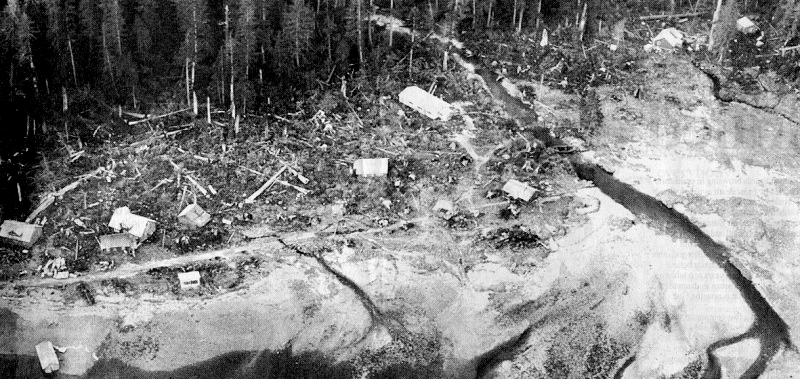
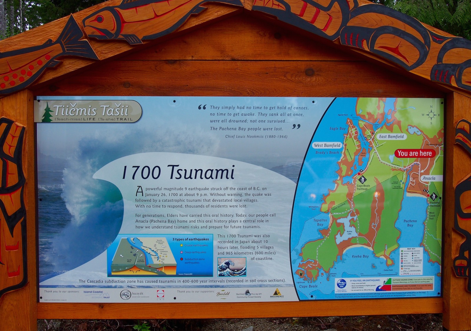
No surveys of comparable scope and magnitude have been done before despite the region’s proximity to the Cascadia Subduction Zone and historic vulnerability to destructive, sometimes catastrophic tsunamis. The zone is a collision point of subsea tectonic plates that last wrought disaster for the Pachena Bay people with a devastating tsunami in the middle of the night 321 years ago.
Large, prehistoric tsunami sites along the Island’s west coast have been identified through geology. These include sites in the territories of every nation from Huu-ay-aht to Che:k'tles7et'h'. Earthquake early warning sensors, land-based and on the sea floor, have been installed in recent years, but there remains a gulf in understanding the physics of coastal flooding, the so-called “tsunami gap.”
In a preliminary report, SRD staff pointed to a data deficiency that limits the ability of local governments to adequately plan and prepare for the next major tsunami event.
A total of 282 residents responded to the public feedback survey. All respondents in communities such as Quatsino, Zeballos and Kyuquot indicated they know the signs of an incoming tsunami: A rapid and unexpected recession of water level and a loud roaring sound coming from the ocean. There also appears to be a reasonable degree of preparedness with 67 per cent of respondents overall indicating they have enough disaster supplies to last two weeks, according to survey results.
In contrast, a little more than half of respondents said they know their community’s tsunami meeting points. Forty-two percent said they do not know evacuation routes. When asked, “Do you know how your community will alert you if there is a tsunami threat,” only 52 per cent answered Yes.
The survey findings should help inform local and regional planners of emergency measures required. A similar wave-modelling project for the south Island’s Capital Regional District has been updated with results expected in September.
“Their input has provided a great deal of support with helping us understand what the community's concerns are associated to tsunamis and what they have learnt from their past experiences with tsunami on the northwest coast of Vancouver Island,” said Shaun Koopman, SRD protective services co-ordinator.
Some of their accounts are included in survey results, which are available at https://srd.ca/wp-content/uploads/2021/07/Community-Tsunami-Survey-Feedback-Report.pdf.
“From Holberg and Winter Harbour to Cape Scott, residents and businesses are depending on old, obsolete analogue Telus service/phone lines in case of emergencies,” wrote one respondent. “These lines are no longer supported by Telus and with no cell service the only way to notify people of imminent danger is by going door to door.”
“I'd like to see something much more like the Oregon coast which has clear tsunami signage and routes for safe places to go,” wrote another.
Kyuquot respondents expressed interest in more public education, training, drills and exercises.
No pre-registration is required for the 90-minute online sessions scheduled for Aug. 18, 1-2:30 p.m., Aug. 19, 7-8:30 p.m., Aug. 25, 1-2:30 p.m. and Aug. 26, 7-8:30 p.m. The same content will be presented in each session. Event Zoom links are available online at www.srd.ca/nwvi-tsunami-risk-project.


