It’s been almost a year since Mount Underwood erupted south of Port Alberni, quickly spreading across a bone-dry slope to become the largest wildfire the area has seen in over a century. While this forest fire season has been relatively mild by comparison, some residents are questioning if slash left over from past logging fueled the rapid growth of the blaze in August 2025.
Despite concerns in May that prompted the earliest campfire ban ever in the Coastal Fire Centre, halfway through the summer this wildfire season has been uncharacteristically moderate on Vancouver Island. As of the end of July the top two thirds of the Island were under a “very low” fire danger rating, while the B.C. Wildfire Service had no fires of note or any out-of-control blazes on Vancouver Island.
But last year the summer unfolded in an altogether different manner. July brought hardly any rain, leading to extremely dry forest conditions in August. The days were hot as well, and by 1 p.m. on Aug. 11, 2025 the mercury at an Alberni Valley weather station had already reached 34 Celsius, following several days of temperatures in the mid 30s. Since late July the Wesley Ridge wildfire had been burning the slope over Cameron Lake.
“We were also at the tail end of an outflow event, which is a drying event where we see a warm air mass coming in from the mainland,” said Brandi Burns of the BC Wildfire Service during an event hosted by the Alberni Valley Transition Towns Society on May 20.
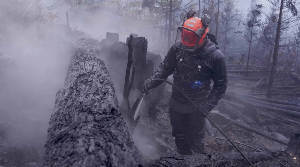
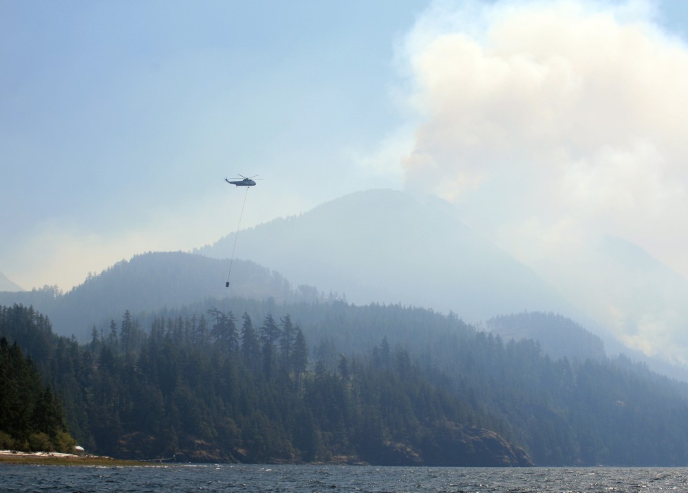
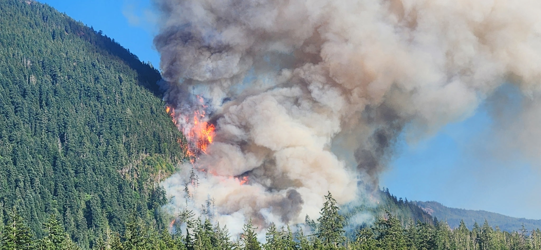
Later in the afternoon of Aug. 11, 2025 a fire started on the slope over the China Creek Marina and Campground, quickly spreading up Mount Underwood to send a mushroom cloud into the sky over nearby Port Alberni. By 7 p.m. that evening the wildfire was believed to be 50 hectares, growing to 100 an hour later, 150 at 9 p.m., then 630 hectares at 10 p.m., said Burns. By the following morning Mount Underwood had grown to 1,447 hectares.
“It was underpredicted. We were seeing very unexpected and difficult to predict fire behaviour,” she said. “It was a combination of extreme drought conditions, dry weather systems, steep slopes and fuel loading in the form of slash that kind of added up to what we saw.”
During those early hours the BC Wildfire Service conducted modelling to predict that Mount Underwood would grow at a rate of 14 metres per minute. This considered “the dominant fuel type” in the area, which is cedar, fir and hemlock trees, said Burns.
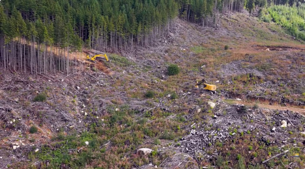
But fires spread even faster in slash, which is the woody debris left on the forest floor from logging. This has become an issue for the Evergreen Alliance, a group of B.C. citizens concerned about forestry’s impact on the environment. They filed a complaint to the Forest Practices Board about cutblock conditions that may have fueled the Mount Underwood wildfire.
“BC Wildfire Service described that behaviour as ‘explosive’,” stated the alliance. “We are concerned that the fire’s behaviour and size were the direct and foreseeable result of fuel hazard conditions created by rapid logging and establishment of conifer plantations on the private property that was involved in the fire.”
‘It was caused by human activity’
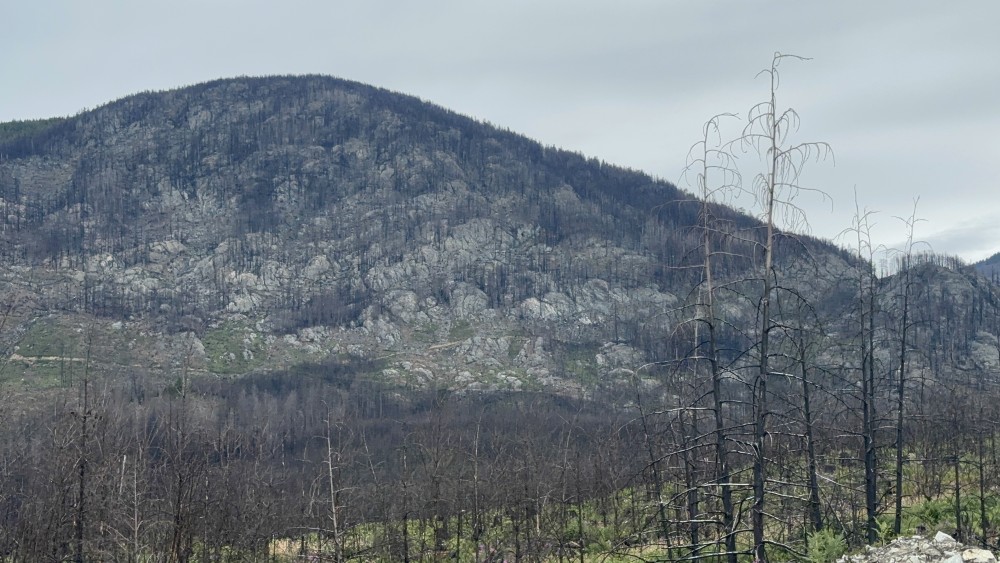
After three days of rapid growth, rain came on Aug. 14, slowing down Mount Underwood and giving wildfire personnel a better chance to suppress the fire and establish perimeter guards. Months of monitoring followed, and the wildfire was officially declared out on Dec. 8, 2025. At 3,518 hectares, it’s the biggest wildfire ever recorded in the Alberni Clayoquot Regional District, the next largest in the region being a 1,035 forest fire in 1926. Mount Underwood spread through a vast combination of Crown land that falls within Tree Farm Licence 44 and private land being managed by Mosaic Forest Management.
With an investigation still underway, the BC Wildfire Service has not disclosed what caused Mount Underwood. But Mosaic believes that “preliminary information suggests it was caused by human activity.”
“There were no active forestry operations in the area at the time the fire started,” stated Mosaic.
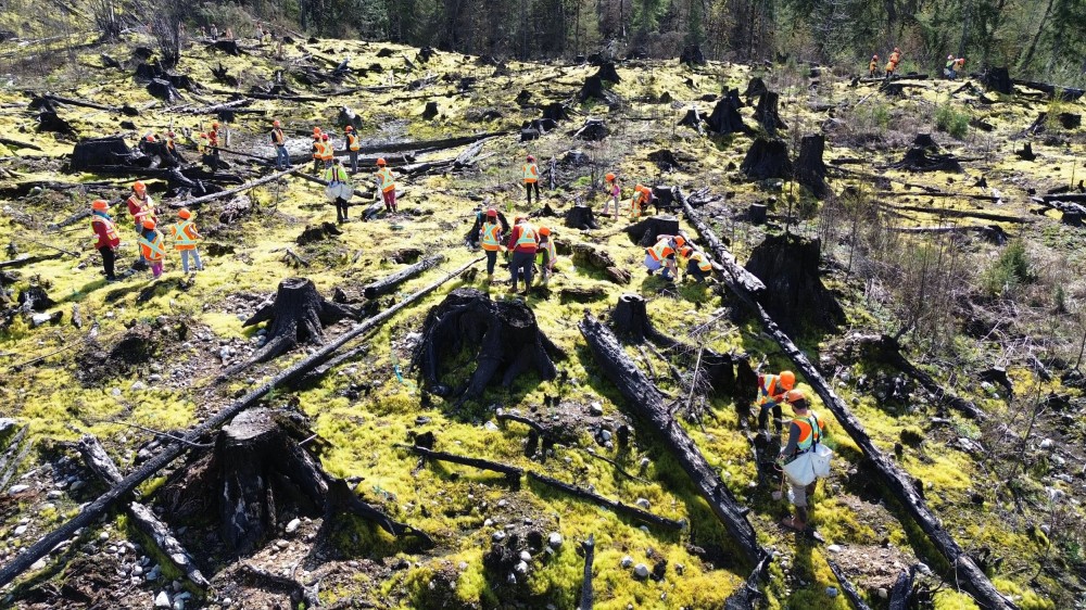
Through its own investigation, the Evergreen Alliance says that clearcuts and young plantations comprise 68 per cent of Mount Underwood’s footprint, which is now a sprawling expanse of charred earth that spreads on either side of the road running south from Port Alberni to Bamfield. The alliance has also identified a 20-year-old plantation just uphill from where Mount Underwood is believed to have started, a block of private land that was harvested by Island Timberlands and now falls under the management of Mosaic. A collection of satellite images compiled by the alliance dating back to 1998 shows a patchwork of clearcuts in the area where Mount Underwood saw its rapid spread.
Mosaic has disclosed that 2,400 of its land burned, comprising 68 per cent of the total spread of the wildfire. Mount Underwood’s 3,518-hectare footprint is nearly nine times the size of Vancouver’s Stanley Park.
“We have every reason to invest in protecting these forests from fire, insects and other threats,” stated Mosaic. “Ensuring the long-term health and value of these forests is fundamental to our business.”
Lack of regulations for private forest
Some of the many images and videos taken by the BC Wildfire Service during the forest fire show collections burned logging debris in the affected area, leading some to wonder if an excess of slash served as matchsticks to help ignite Mount Underwood.
On Crown land the provincial government enforces a “take-or-pay” approach, requiring tenure holders to submit a waste management assessment after logging that is subject to auditing to verify compliance.
“Once an assessment has been accepted, a waste invoice is issued for waste timber left on site that is subject to billing,” wrote the B.C Ministry of Forests in an email to Ha-Shilth-Sa. “A limited amount of waste may be left on site without incurring waste charges. This allowable volume is referred to as the benchmark, and benchmark levels vary based on factors such as ecosystem type and harvesting methods.”
“Industrial activities must not increase the risk of a fire starting or increase expected fire behaviour compared to conditions before the activity began,” added the ministry.
Under B.C.’s Wildfire Act, anyone conducting industrial activity is required to assess and reduce any fire hazards that result from their practices. But the province doesn’t currently keep an inventory of any hazardous debris being left on private forest land.
Kaitlin Murphy is the FireSmart project coordinator for the Alberni-Clayoquot Regional District. During the Transition Towns event on May 20 she addressed this issue, saying that the regional district’s approach is “to engage whenever we can and to try and get a dialogue going with those private managed forest lands.”
“Because most of us up here are not responsible for managing private managed forest lands, we don’t have a mechanism at this time for controlling and essentially enforcing certain practices,” she said. “It’s really difficult for us to say, ‘You have to do this’, because we don’t have authority on those types of land ownership. We only have authority over publicly owned land.”
As it manages 550,000 hectares of forest across Vancouver Island and the Sunshine Coast, Mosaic says it’s only in the company’s best interests to mitigate such hazards.
“Mosaic manages its private forest lands with a long-term focus on forest health, productivity and resilience, including wildfire prevention, preparedness and recovery,” said Steve Mjaaland, the company’s director of Forest Protection.
Satellite monitoring to spot ignitions
This year the ACRD is updating its Community Wildfire Protection Plan. The last plan from 2019 included a recommendation that the regional district “work with private property owners to ensure they understand the importance and principles of FireSmart” regarding the removal of hazardous fuel types. But so far the new version of this plan and its maps don’t have input from Mosaic.
“That map is not likely to show privately managed forest lands unless there is an agreement in place for us to be able to show those publicly,” said Murphy.
“Mosaic has not been asked to contribute to the Alberni-Clayoquot Regional District’s Community Wildfire Resiliency Plan update,” responded the company. “Mosaic remains available to discuss how we may support the process.”
The forestry company has clearly been impacted by the toll of the 2025 wildfire season, and this year has announced measures to better mitigate hazards. In 2026 Mosaic started a pilot detection system in the Nanaimo Lakes region, using cameras, ground-level sensors and low-orbit satellite monitoring to spot ignitions.
“Mosaic is focusing on high-utilization harvesting to minimize residual woody debris,” noted the company. “Post-harvest treatment – chipping, grinding, prescribed burning and salvage efforts – further reduce risks.”