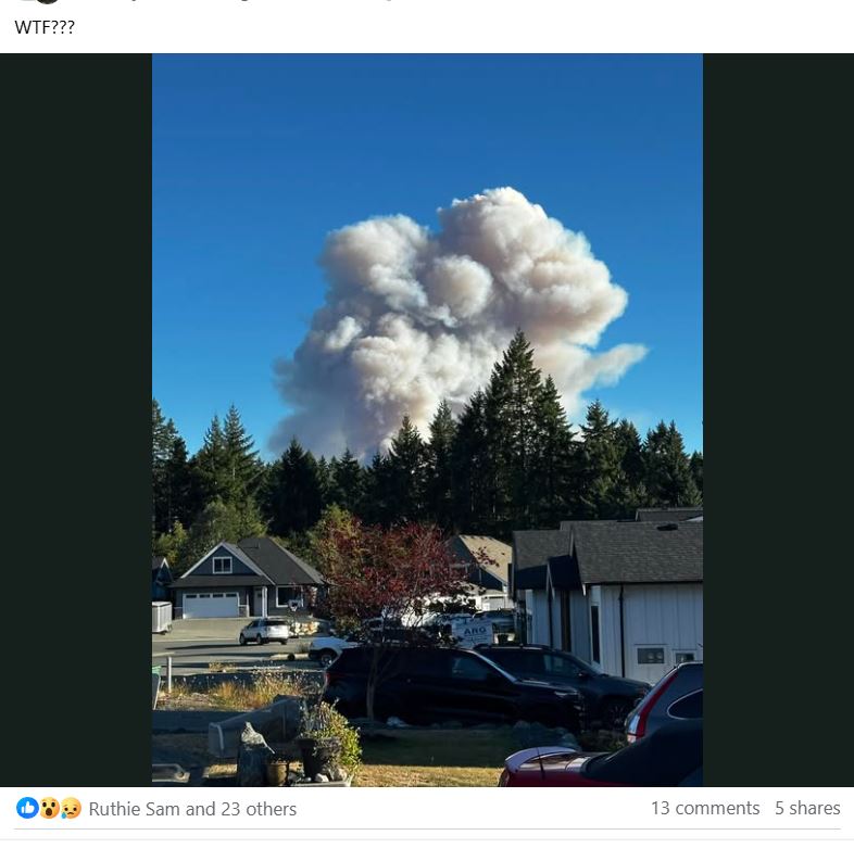
A rapidly growing wildfire south of Port Alberni has sent a current of anxiety through the community, leading officials to caution residents to be selective in their sources of information to avoid unnecessary panic.
First emerging at about 6:30 p.m. on Monday, Aug. 11, the Mount Underwood wildfire burned at an explosive rate, growing to 3,406 hectares in less than three days. This brought the evacuation of the nearby China Creek Campground and Marina as well as the closure of the road that runs through the evacuation zone from Port Alberni to Bamfield. Since Monday evening the communities of Bamfield, Anacla and Nitinaht have been without power.
Besides the order to leave the China Creek facility and other spots in the vicinity of the blaze, an evacuation alert was issued on Aug. 13 for the Tseshaht reserve at Polly’s Point and the southern Port Alberni neighbourhood of Cameron Heights.
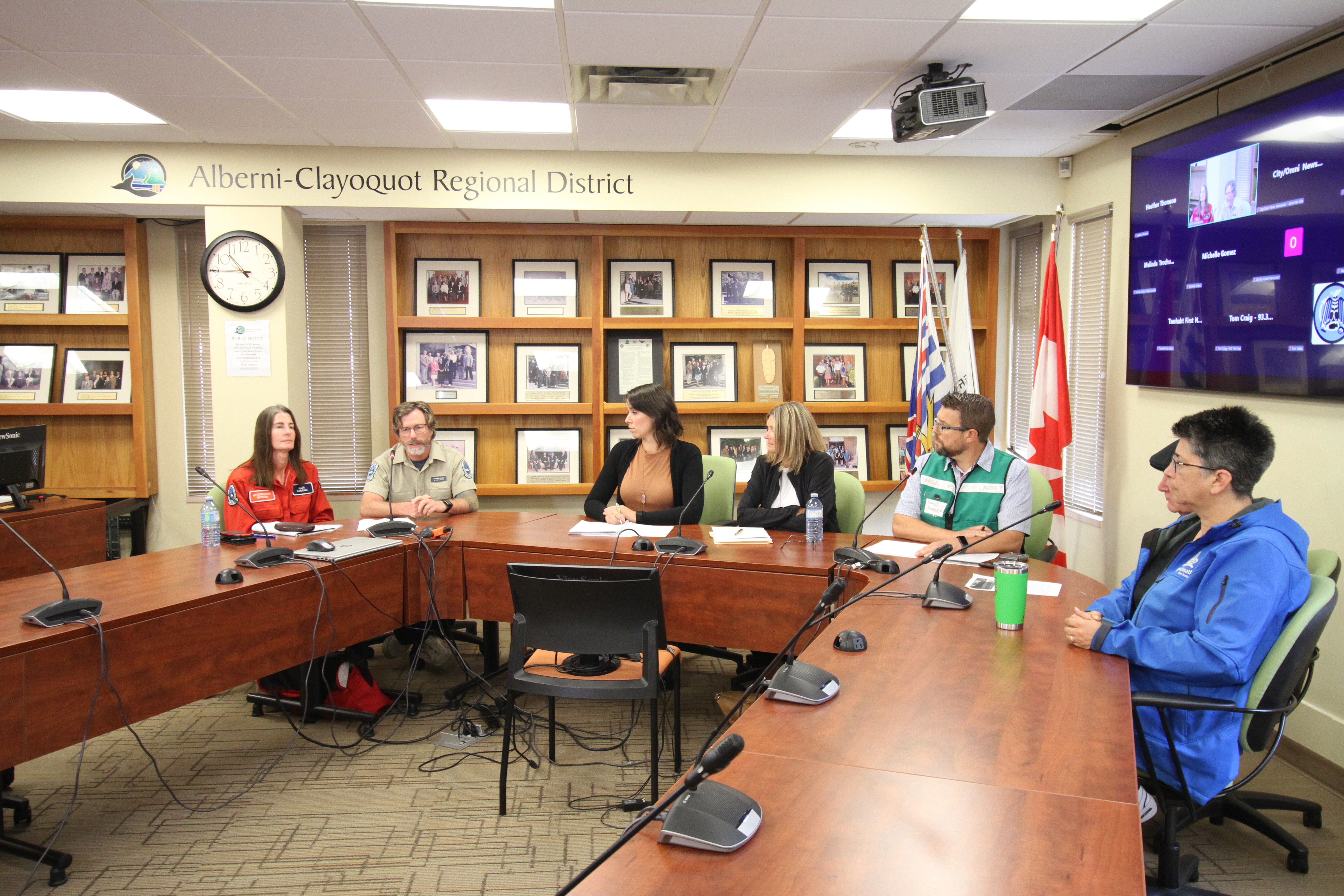
Although “the fire has spread closer to the community,” this alert does not mean residents of these areas should leave, stressed Port Alberni Mayor Sharie Minions.
“We don’t feel that there is any imminent threat, otherwise we would be issuing additional alerts and orders,” she said during a press conference on Thursday, Aug. 14. “This is an alert only and means residents should be prepared to leave on short notice, but nobody is required to leave, nobody needs to leave imminently.”
Thick smoke has hindered the ability of the BC Wildfire Service to know how big the spread actually is. For a day the extent of Mount Underwood’s perimeter wasn’t clear.
“We know that there has been growth, we’re working find that perimeter right now,” said Stefan Hood, the B.C. Wildfire Service’s incident commander for Mount Underwood and Wesley Ridge, during the morning press conference. “Access is a real challenge. We’ve got several roads that have been impacted by the fire. Debris from the fire has been compromising the safety of travelling those roads.”
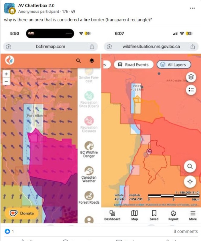
Meanwhile, as is often the case with public emergencies, social media has been the quickest source of information – although the accuracy of what is being reported has been inconsistent.
Along with the City of Port Alberni and the Alberni-Clayoquot Regional District, the Tseshaht First Nation has declared a state of emergency. The First Nation has been disseminating information about the wildfire from official sources, but what members are relying on remains a concern.
“The biggest thing going on right now is misinformation,” said Tseshaht Councillor Les Sam during the press conference. “We need to deal with facts and not fiction on this fire.”
“We’re constantly getting sent weird maps, Tick Toks, information that’s not from here, photos where they zoomed right in, going ‘It’s right on the top of the mountain!’ I can look at it from my backyard, it’s not there,” added Brandy Lauder, chief councillor of the Hupacasath First Nation. “Try to keep people calm. There’s always room to be prepared and ready, but there’s no real need as of yet to panic.”
Online tools, such as MODIS and FIRMS, use satellites to detect heat sources, producing maps for hot spots in the area of the Mount Underwood wildfire. These can be accessed by the public, but might not provide an accurate picture of where the forest fire exactly is, advised Hood.
“What it’s really showing is the heat source. The heat source is the flames on the ground, but it’s also the smoke in the air,” he said. “That shouldn’t be misrepresented as being an accurate mapping tool of where the perimeter of the fire currently is.”
By 3 p.m. that afternoon the expected rain began to fall in the region. After a week that began with temperatures in the mid 30s, this brought a welcome change for the firefighters. Rain is forecasted to continue through the weekend.
“It’s not going to put out the fire, but it should help us in terms of limiting fire growth for a period of time until it gets warm again,” said Hood. “We have a lot of heavy fuel out there. Rain will only buy us some time to get our crews in there, get heavy equipment in there to construct some guards and then work from those anchor points.”
Mount Underwood is currently the province’s only “Wildfire of Note”, and by Thursday an incident management team assumed control, overseeing 87 firefighters on the ground, with 14 structural protection specialists and 10 tree fallers. Eleven helicopters are also being used - including two with night vision technology – plus heavy equipment to clear debris and help establish a fire guard.
“We have all sections represented from operations, planning, logistics, finance, safety and info,” said Hood of the specialized team he is leading. “It’s a collection of skilled individuals. We come together from all parts of the province and find ourselves often at the most challenging and the most impactful fires in the province.”